LiDAR Sensing Technology
Outline of the Technology
We are conducting research and development on infrastructure-based LiDAR sensing technology to support a safe transportation system.
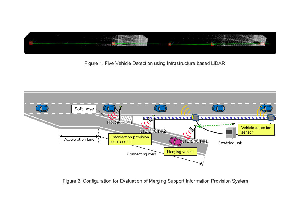
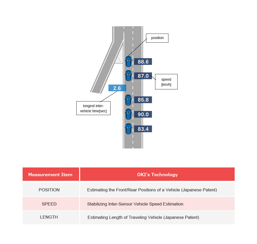
Our technology can precisely measure the three-dimensional position, velocity, and length of moving vehicles and people in real time using high-resolution LiDAR.
In addition, we are also conducting research and development on point cloud calibration, together with various measurement technologies such as GNSS positioning and IMUs (Inertial Measurement Units).
OKI’s Unique Strength Demonstrated in This Technology
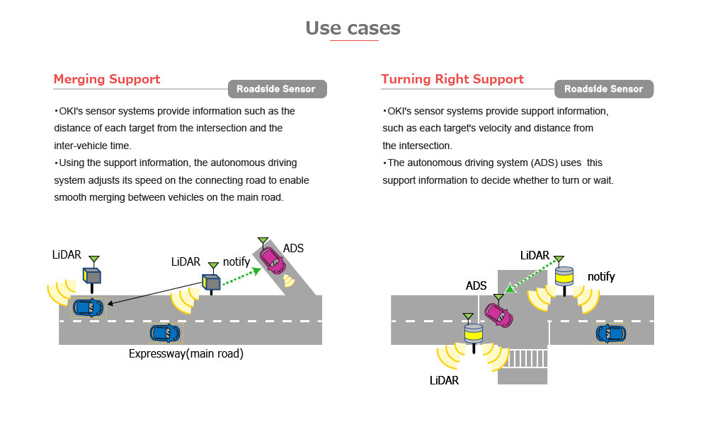
Real-time Vehicle Measurement Technology
- OKI's sensor systems precisely measure the front and rear position, speed, and length of moving vehicles using integrated sensors installed along the roads.
- The support systems send the support information,such as the distance of each target from the intersection and the inter-vehicle time, to the autonomous driving system in real-time (every 0.1 seconds)
Vision for Future Development
In an effort to create new solutions to resolve social issues (reducing traffic accidents, etc.), OKI is conducting research and development on infrastructure-based LiDAR sensing technology to support a safe transportation system.
LiDAR has high environmental resistance, and together with OKI’s advanced signal processing, real-time processing is performed on the edge computer.
In addition, together with OKI's V2X wireless communications technology and radar systems, it aims to detect moving vehicles and pedestrians over a wide area and notify in real time with low latency.
OKI aims to enhance the social infrastructure through its LiDAR sensing technology and realize its goal of “Delivering OK! to your life.”